


Voting District 01-39, Sussex County, Delaware
About
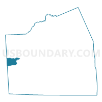
Outline

Summary
| Unique Area Identifier | 550635 |
| Name | Voting District 01-39 |
| County | Sussex County |
| State | Delaware |
| Area (square miles) | 12.70 |
| Land Area (square miles) | 12.70 |
| Water Area (square miles) | 0.00 |
| % of Land Area | 100.00 |
| % of Water Area | 0.00 |
| Latitude of the Internal Point | 38.66293670 |
| Longtitude of the Internal Point | -75.67061950 |
Maps


Graphs
Select a template below for downloading or customizing gragh for Voting District 01-39, Sussex County, Delaware


Neighbors
Neighoring Voting District (by Name) Neighboring Voting District on the Map
- Voting District 02-39, Sussex County, DE
- Voting District 03-35, Sussex County, DE
- Voting District 05-39, Sussex County, DE
- Caroline Precinct 05-001, Caroline County, MD
- Dorchester Precinct 01-001, Dorchester County, MD
Top 10 Neighboring County Subdivision (by Population) Neighboring County Subdivision on the Map
- Seaford CCD, Sussex County, DE (25,116)
- District 5, Federalsburg, Caroline County, MD (4,841)
- District 1, Fork, Dorchester County, MD (1,985)
Top 10 Neighboring Place (by Population) Neighboring Place on the Map
Top 10 Neighboring Unified School District (by Population) Neighboring Unified School District on the Map
- Caroline County Public Schools, MD (33,066)
- Dorchester County Public Schools, MD (32,618)
- Seaford School District, DE (23,574)
Top 10 Neighboring State Legislative District Lower Chamber (by Population) Neighboring State Legislative District Lower Chamber on the Map
- State Legislative Subdistrict 37B, MD (86,699)
- State House District 35, DE (22,751)
- State House District 39, DE (19,663)
Top 10 Neighboring State Legislative District Upper Chamber (by Population) Neighboring State Legislative District Upper Chamber on the Map
- State Senate District 37, MD (129,289)
- State Senate District 19, DE (48,816)
- State Senate District 21, DE (44,799)
Top 10 Neighboring 111th Congressional District (by Population) Neighboring 111th Congressional District on the Map
Top 10 Neighboring Census Tract (by Population) Neighboring Census Tract on the Map
- Census Tract 504.06, Sussex County, DE (4,996)
- Census Tract 9556, Caroline County, MD (4,836)
- Census Tract 504.01, Sussex County, DE (3,794)
- Census Tract 504.05, Sussex County, DE (3,713)
- Census Tract 9701, Dorchester County, MD (2,821)